Montacute Maps through Time
According to British History Online (Victoria County History) Montacute was of sufficient importance to have been visited by Henry III in 1250 and in 1340 the borough had the ninth highest tax in the county, but Montacute's significance declined in the 16th century.
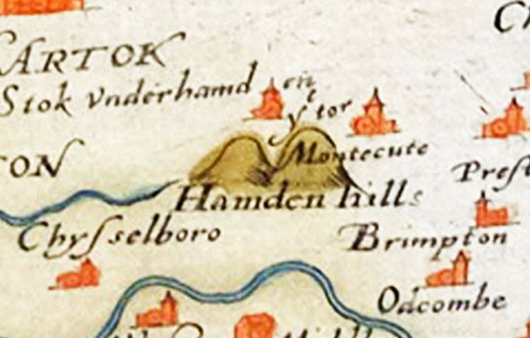
Montacute is clearly marked on Christopher Saxton's 1579 map of Somerset (below); St Michael's Hill is indicated as 'ye tor'. It is interesting that there are no roads marked on this map. Note the old name for Yeovil, 'Evill' -

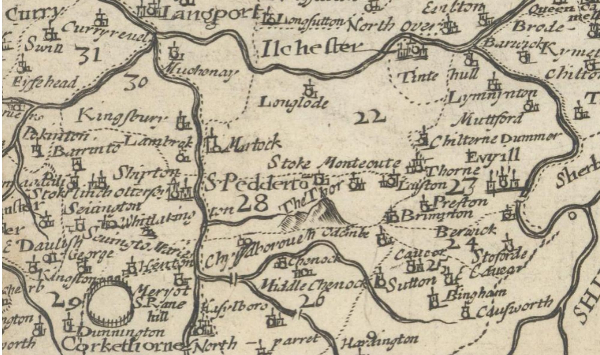
And again Montacute and the hill are indicated on John Speede's 1611 map, with the hill labelled as 'The Thor' and this time with local 'roads' marked (see below):

These maps (above) were drawn up after the dissolution of the Montacute Priory in 1539. We know from Leland that in 1542 Montacute Priory Chapel stood on the mound of the old Norman motte and bailey castle on St Michael's Hill, but we also know from Thomas Gerard of Trent that in 1633 the Chapel was in ruins. So the etymology of 'tor or 'thor' labelled on the above maps could derive from the Old English 'watchtower' and/or the Middle English 'rocky hill'. The present-day tower on the hill was not built until 1760.
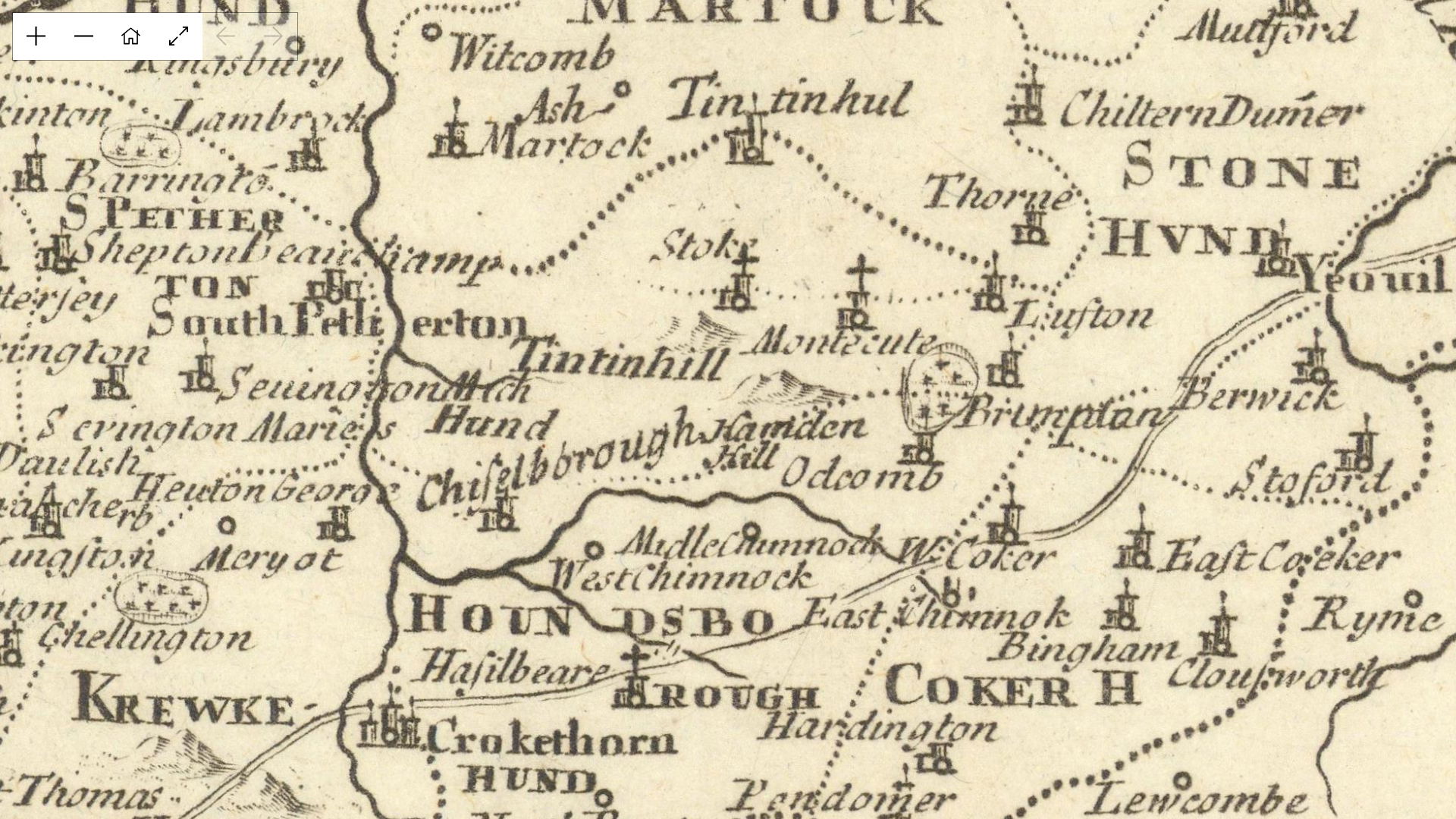
Montacute and The Thor appear on a 1673 map of 'the County of Somerset, with its Hundreds', by Richard Blome (also being sold by antiquemapsandprints.com). On this map I think the round symbol in the bottom left of the image indicates parkland, possibly Hinton Park.
The Thor is not labelled on this map from 1695 by Robert Morden but we now also see the round symbol, possibly indicating a park, alongside Montacute and also by Barrington:
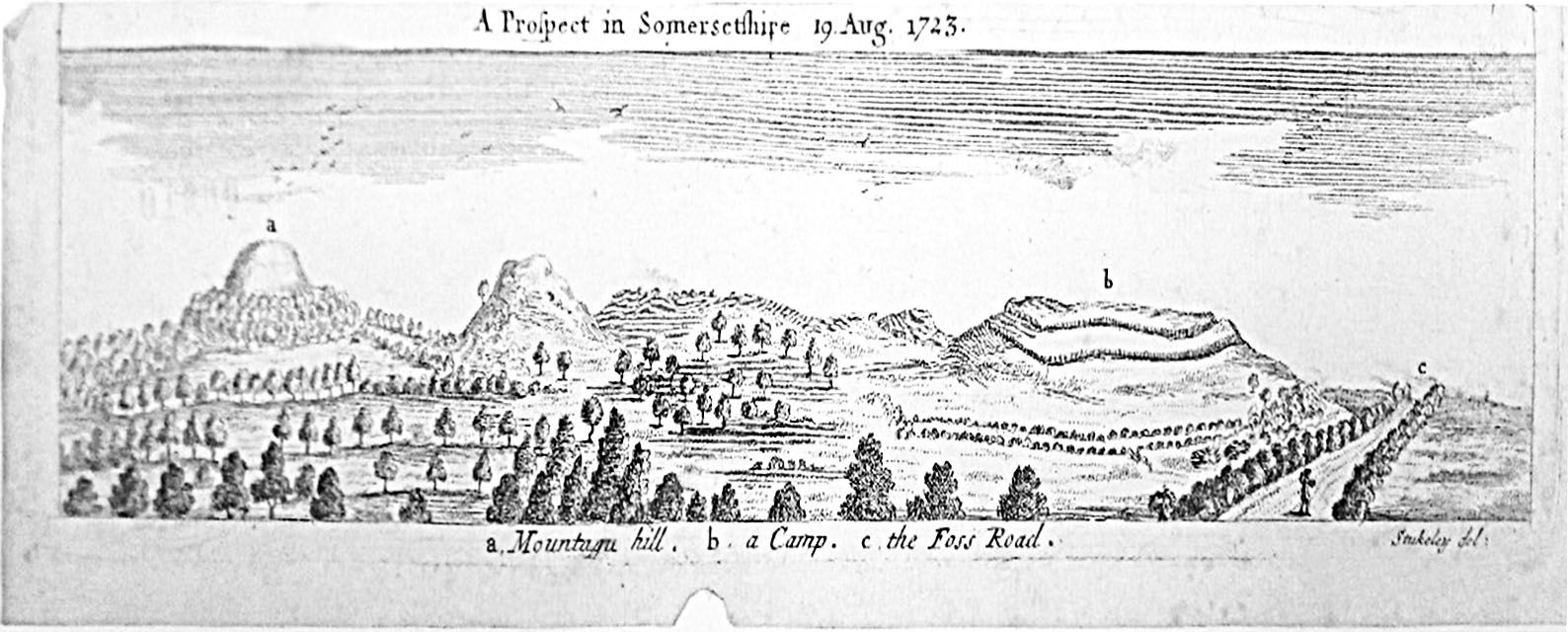
The antiquarian William Stukeley (1687–1765) drew many archaeological sites including the view below (dated 1723) of Montacute Hill, Hedgecock Hill and Ham Hill as seen from the Fosse way. It is intriguing that no dwellings or churches are depicted:
The absence of Montacute on a 1724 map by Moll and on a 1753 Map of Somerset-Shire by John Owen and Emmanuel Bowen may indicate a decline in the significance of the village leading up to this time.
The earliest map I can find that gives a layout of the roads through Montacute is a map probably drawn by Samuel Donne dating from around 1782; the original was missing from its place in the Phelips Papers when deposited in the Somerset County Record Office. J.H.C. Phelips acquired a photocopy of part of the lost original and The Country Life Magazine archives has a photograph that may be of this photocopy. I can't show it here for copyright reasons but it is worth clicking on the link to have a look at it. Using this photocopy, in 1981 J.H.C. Phelips had Robert Pearce RIBA draw up a copy the 1782 map of Montacute; also copyrighted, this map is held by the National Trust. On this map the road east of the house appears as minor track while the major road through the village runs west of the house. This road was adopted by the Ilminster Turnpike Trust in 1781 (click link for map of turnpike roads in Somerset). Possibly influenced by this, in 1786 the fifth Edward Phelips created an new entrance on the west side of the house using the porch from Clifton Maybank house.
The next oldest map I found is the 1803 'Patterson's British Itinerary' route map for 'London to Taunton by Yeovil' (antiquemapsandprints.com). In the image below I show this and the same route marked in red on a modern map. It is interesting to see that in 1803 the recommended route from Yeovil to Montacute went through Lower Odcombe; also the location of Hamdon Hill on the 1803 map seems slightly misplaced to the north and east (the map places it too far up and to the left):
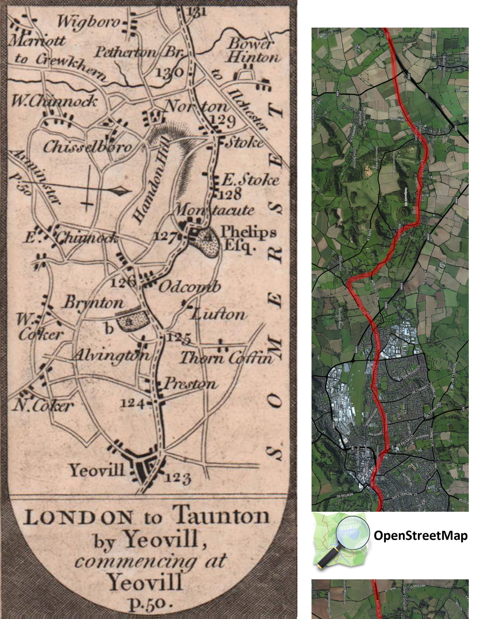
OpenStreetMap® is open data, licensed under the Open Data Commons Open Database License (ODbL) by the OpenStreetMap Foundation (OSMF).
A map from a similar time is from the 1805 Georgian and Victorian Ordnance Series Old Series map published on Archi UK; this map also shows the road from Yeovil to Montacute passing through lower Odcombe.
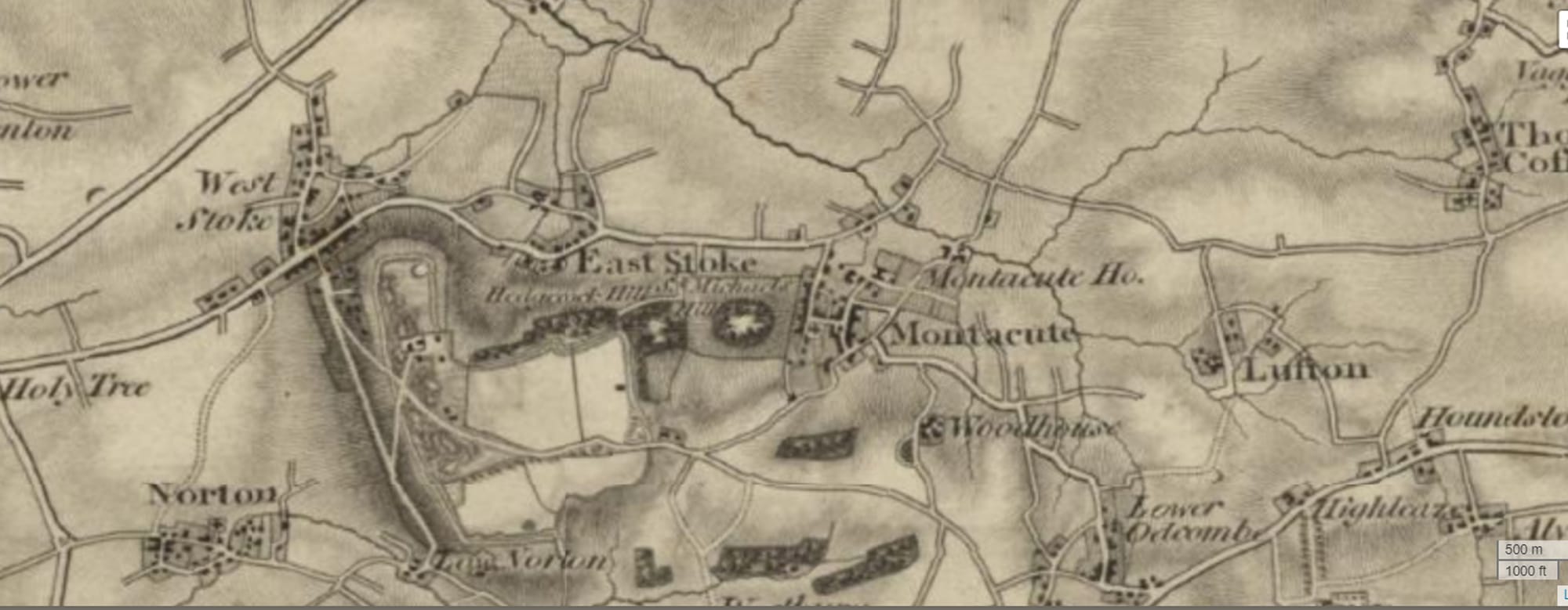
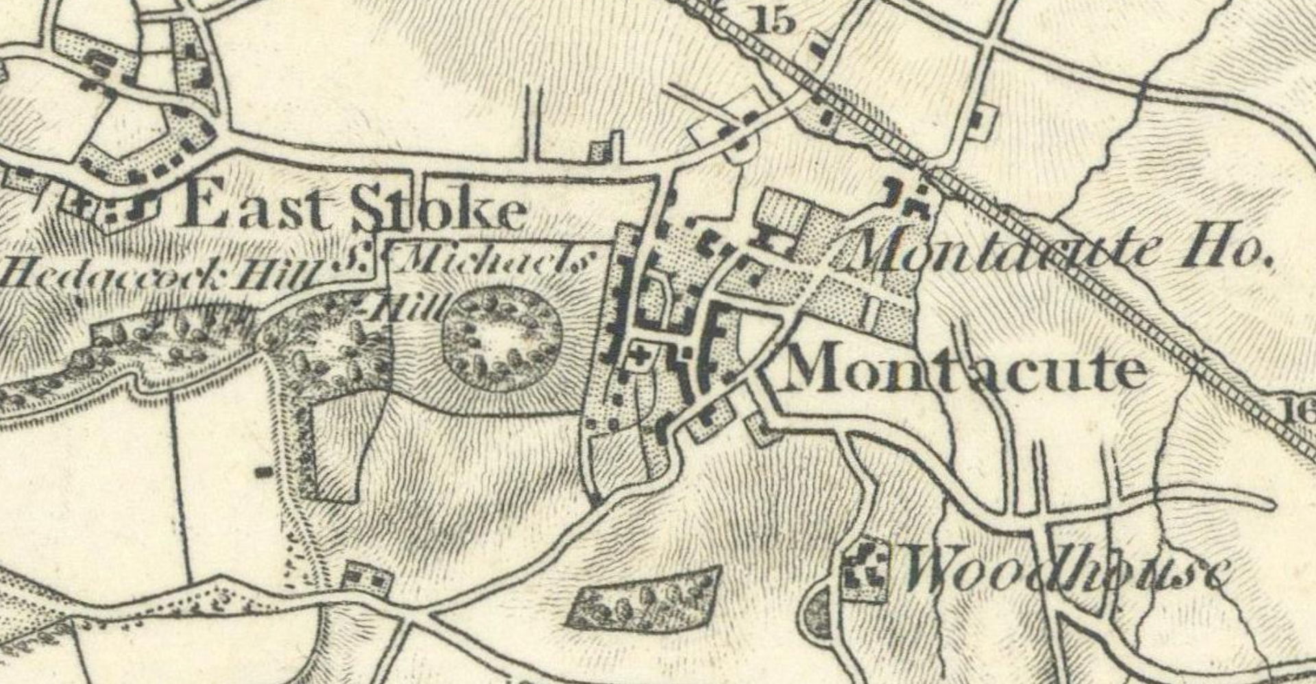
The close-up of another copy of this same 1811 map by Mudge, published by the Ordnance Survey, clearly shows the road that passed east of Montacute House. This map was drawn up before the main road through Montacute was altered and before the creation of the current west drive:
The picture below was painted in 1825 by James Johnson; the church tower is visible behind the house on the right of the picture but on St Michael's Hill the tower is not shown:

An 1825 map of Montacute Parish and an 1840's tithe map also both show the road through Montacute in its original form, without the new tree-lined west drive but with the previous (north-west) drive. The image below is the 1840's tithe map accessed on the map database 'Kypwest':

The 1840 map above shows the road running past the east of the house as a minor road, and a major road running past the west of the house. It clearly shows the north-west drive that was created when the front porch was built onto the house. This drive had a turning circle in front of the west aspect of the house and joined the old Tintinhull Road junction which was subsequently diverted. In the picture below I show the approximate route of the present-day roads overlaid on the map. The main road through the village is indicated with red dots, the new Montacute House West Drive in yellow, and Back Lane in purple. The old road junction for Tintinhull (between plots 111-115 and 201 on the tithe map) was incorporated into land that now includes the orchards of Montacute House.

The 1844-1888 OS series map of Montacute (again from the fantastic Kypwest website) shows the altered route of the main road through the village and the new Tintinhull turning; I have indicated the previous location of the roads and the Tintinhull Junction in red:
